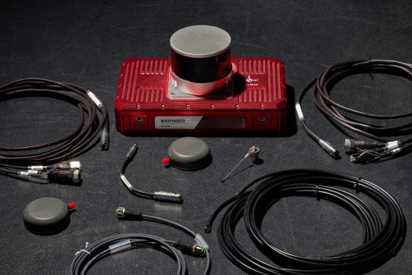
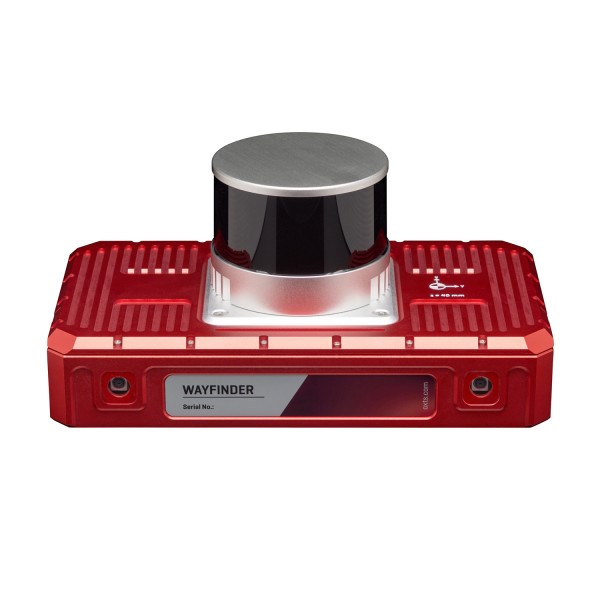
OXTS WayFinder is a real-time localisation platform for challenging GNSS environments, enabling seamless transitions between open-sky areas and spaces where GNSS is degraded or unavailable. It combines GNSS, an IMU, LiDAR and cameras to deliver precise navigation data with minimal setup effort.
Designed as an out-of-the-box solution, WayFinder reduces the complexity of navigation in tunnels, underground spaces, urban canyons and indoor/outdoor transition zones. Its LiDAR Boost capability uses integrated LiDAR data to compensate for missing or erroneous GNSS updates in real time.
Applications
- Navigation in GNSS-denied or partially obstructed environments
- Autonomous robots and automated guidance systems
- Operation in tunnels, underground areas and urban canyons
- Projects that need a fast-to-deploy integrated localisation platform
Key specifications
- Position accuracy: 0.01 m
- Heading accuracy: 0.05°
- Pitch/Roll accuracy: 0.02°
- Velocity accuracy: 0.05 km/h
- GNSS-denied position accuracy: 0.03 m
- Integrated sensors: dual GNSS, IMU10, LiDAR and cameras
- Key capabilities: LiDAR Boost, low-dynamics warm-up, free NAVsuite software